
Imagine a day dedicated to the magic of maps and the power of place! GIS Day steps into the spotlight once a year, wrapping the globe in a digital hug of geographical wonder.
It’s not just any day; it’s a global party for Geographic Information Systems (GIS), falling on the third Wednesday in November.
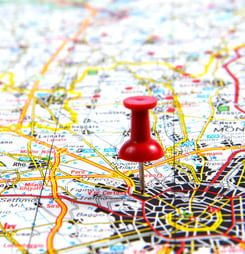
What Are Geographic Information Systems (GIS)?
Geographic Information Systems (GIS) are digital platforms for storing, analyzing, and visualizing geographic data.
These systems help users understand patterns and relationships in spatial data. GIS technology combines location data with descriptive information to provide detailed maps and analyses. It’s widely used in various fields, such as urban planning, environmental management, and public safety.
By processing spatial and geographical data, GIS enables better decision-making and problem-solving. Essentially, it turns complex data into easily understood visual formats, enhancing our ability to analyze our world.
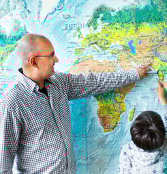
Why throw a party for GIS? Picture a world where every map tells a story, from tracking the spread of a virus to finding the best spot for a new park. GIS technology stitches together data and geography to paint these pictures, guiding decisions that shape our world.
It’s a celebration of technology that helps us understand our planet better, save lives, and even explore Mars! Over the years, GIS Day has become a platform for sharing innovations and inspiring future map wizards.
The seeds for this day were sown by visionaries who mapped the uncharted from the dawn of GIS in the 1960s to today’s digital explorers.
Every GIS Day is a chance to geek out on treasure hunts, join story map competitions, and dive into the latest geospatial marvels. It’s a day for everyone, from professionals to enthusiasts, to explore how GIS technology touches lives and reshapes our understanding of the world.
So, let’s get ready to explore, learn, and celebrate the incredible world of GIS this November 20. Who knows? You might find yourself starting an adventure, one map at a time!
History of GIS Day
Let’s take a trip down memory lane to the birth of GIS Day, a day that turns the spotlight on maps and the tech behind them.
It all kicked off in 1999, thanks to the brainy folks at Esri and a little nudge from Ralph Nader. He thought, “Why not have a day for everyone to explore the wonders of geography and GIS?” And just like that, GIS Day was born.
This special day falls on the third Wednesday of November every year, part of the larger Geography Awareness Week.
It’s a time when map lovers, students, and professionals from all over come together. They share stories of how GIS helps us understand the world in new ways. From its first celebration to now, GIS Day has turned into a global event. People from every corner of the planet join in to showcase their mapping projects and innovations.
The goal? To make the magic of GIS known to more people. Whether it’s helping in crises, like tracking diseases or exploring new frontiers on Mars, GIS has a story to tell.
And GIS Day is the perfect time to hear those tales. It’s not just for the tech-savvy. Schools, universities, and communities get in on the fun too. They host workshops, games, and talks to spread the GIS gospel.
So, from its humble beginnings inspired by a desire to educate and engage to its current status as a global festival of geographical wizardry, GIS Day has come a long way. It’s a day to be curious, to explore, and to celebrate the incredible impact of GIS on our lives and the world around us.
How to Celebrate GIS Day
Celebrating GIS Day can be a fun adventure for everyone, not just the map enthusiasts among us. Here are five quirky and playful suggestions to mark the occasion:
Map Your Day
Start your morning by sketching a map of your day. Include places you’ll visit, paths you’ll take, and any treasure spots you hope to discover. It’s a creative way to visualize your daily journey!
Host a Virtual Map Party
Invite friends to a virtual gathering where everyone shares a map that means something special to them. It could be a map of their favorite vacation spot, their hometown, or a fantasy world.
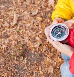
Geocache Adventure
Turn the day into a real-life treasure hunt by trying geocaching. Use your smartphone or a GPS device to find hidden treasures around your city. It’s a fun way to explore new places.
GIS-themed Game Night
Organize a game night with a GIS twist. Play board games that involve map strategy, such as “Risk” or “Ticket to Ride.” It’s a playful way to appreciate the power of geography.
Learn and Share
Take a short online course about GIS technology and share interesting facts you learn with friends or on social media. Spread the word about how GIS is used in everyday life, from navigating traffic to predicting weather patterns.
Create a Story Map
Use a free online tool to create a story map of your community, highlighting local landmarks, history, or personal stories. It’s a digital way to connect with your surroundings and share it with others.
Volunteer for a Mapathon
Participate in a mapathon, where volunteers help map less-known areas of the world. This can be particularly helpful for humanitarian organizations planning disaster response or development projects.
These activities are designed to be engaging and informative, celebrating the world of GIS in a way that’s accessible to all. Whether you’re mapping out your adventure or joining a global effort, GIS Day is about discovering the world through a geographic lens.